")

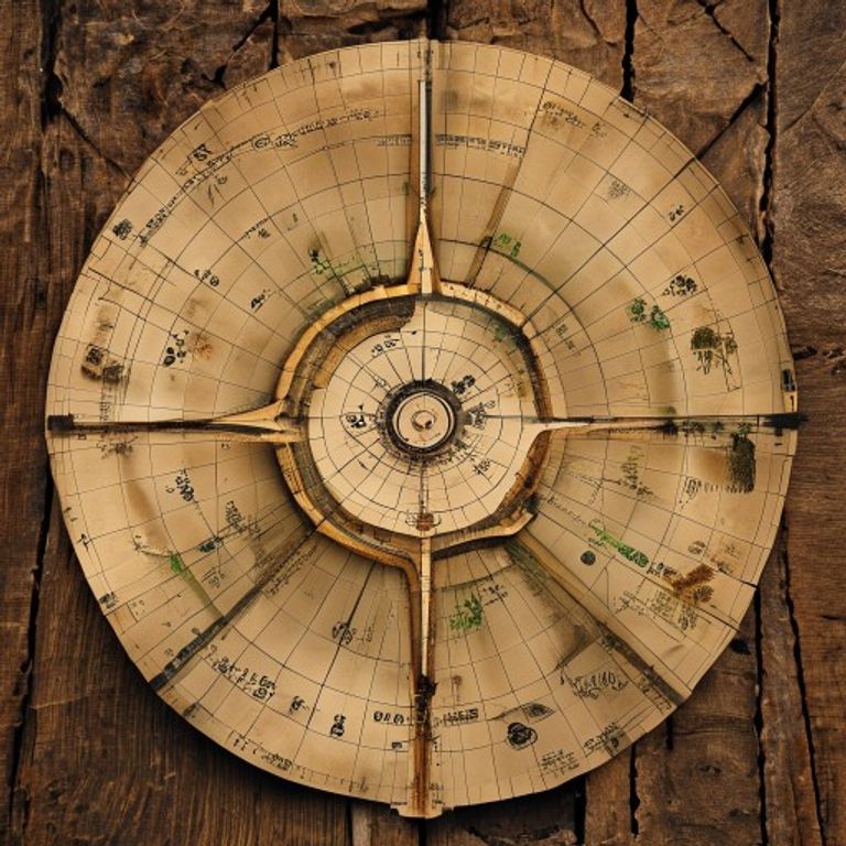
An authentic 16th-century Turkish scroll supposedly depicts the coast of Antarctica in detail and ice-free centuries before its official discovery.
⚠️ Research conducted with the assistance of Deep Research is subject to referential ambiguity.
🖥️ Clean HTML code using a proprietary tool.
👥 Research by Guilherme Felipe, Curation by Sílvio Lôbo
The Piri Reis Map Enigma: Navigating the Murky Waters of an Ancient Mystery
In a world that demands concrete explanations and demystification, some cases persist in challenging logic and science, weaving a web of mystery that spans centuries. Among them, the Piri Reis Map Case stands out as one of the most intriguing historical enigmas, a cartographic anomaly that forces historians, geographers, and, more recently, even enthusiasts of exotic theories, to question the limits of knowledge in ancient times.
This is not a crime report, but rather a deep dive into a historical document that, over time, has become the epicenter of a heated debate, oscillating between the undeniable genius of an Ottoman admiral and the possibility of information sources that transcend the understanding of the era. The story of the Piri Reis Map is a journey through veracity, interpretation, and the relentless pursuit of answers that still float in the waters of unresolved history.
1. The Context and the Incident: Where, When, and How the Mystery Began
The starting point of this enigma dates back to the early 16th century. The protagonist is Piri Reis, a renowned admiral and cartographer of the Ottoman Navy. In 1513, he compiled a unique world map, a gazelle skin parchment that would become world-famous for its surprisingly accurate depictions of coastlines that, it was believed at the time, had not yet been discovered or mapped with such detail.
The map was discovered in 1929 during a survey at the Topkapi Palace in Istanbul by Paul Kahle, a German professor of Oriental studies. The discovery was a shock to the academic community. The map, fragmented and with about a third of its original extent preserved, presented a projection that included parts of the west coast of Africa, the east coast of South America, and, most controversially, a surprisingly accurate depiction of the coast of Antarctica, including its subglacial coastline.
The "incident," therefore, is not an isolated event of crime or disaster, but rather the very existence and content of the map, which challenge conventional notions about the extent of geographical knowledge in the early 16th century. How could Piri Reis, or the sources he used, have known about such distant lands and, especially, an ice-covered continent, at a time when navigation was primarily confined to the North Atlantic and limited portions of the African coast?
2. Timeline of Events
The chronological reconstruction of events related to the Piri Reis Map is crucial to understanding the evolution of the mystery:
- Years before 1513: Piri Reis, active in the Ottoman Navy, had access to a vast collection of nautical maps and documents, both European and from other origins, accumulated in libraries and ports of the Ottoman Empire.
- 1513: Piri Reis compiled his world map in Gallipoli, using various cartographic sources as his basis, as he himself attests in annotations on the map itself.
- Following centuries: The map was preserved, but its existence and details remained unknown to most of the world.
- 1929: Professor Paul Kahle discovered the map during a survey at the Topkapi Palace.
- 1950s and 1960s: The map gained worldwide notoriety with the publication of theories suggesting its anomalous origin, especially the depiction of Antarctica. Geographer Charles Hapgood and ufologist Erich von Däniken were prominent figures in popularizing these ideas.
- Late 20th and early 21st centuries: Various scientific and geographical analyses were conducted on the map, seeking to refute or corroborate the more fantastic theories. The academic community largely dismissed unconventional hypotheses, but the mystery persisted in the popular imagination.
- Current Status: The Piri Reis Map is displayed at the Naval Museum in Istanbul and continues to be an object of study and fascination, without a definitive explanation widely accepted for all its enigmatic aspects.
3. The Main Theories
The mystery of the Piri Reis Map has given rise to a range of theories, from scientific skepticism to bolder speculation:
3.1. Scientific and Conventional Hypotheses
- Mapped and Unknown Sources: The most accepted explanation among historians and geographers is that Piri Reis compiled his map from a vast array of cartographic sources available at the time, including European, Arabic, and possibly even older maps that had survived. The remarkable accuracy would be the result of Piri Reis's skill in synthesizing and interpreting this information. The legend on the map itself, where Piri Reis states he consulted about twenty different maps, including one by Christopher Columbus, is fundamental to this theory.
- Misinterpretation of Antarctica: Some scholars suggest that the supposedly Antarctic section of the map may actually be a distorted or incorrect representation of other coastlines. The Valdes Peninsula in Argentina, for example, is often pointed to as a possible candidate for this alternative interpretation, due to similarities in certain shapes. The geology of the time and the lack of detailed knowledge of South American coasts could lead to misinterpretations of older maps.
- Advanced Cartographic Knowledge: Piri Reis was an experienced cartographer and a seafarer. It is possible that he possessed superior nautical and cartographic knowledge than is generally attributed to his era, allowing him to infer and project information with impressive accuracy, even with imperfect sources.
3.2. Alternative, Conspiracy, and Paranormal Theories
- Advanced Ancient Civilizations: This theory, popularized by authors like Erich von Däniken, posits that the map is evidence of a prehistoric civilization with geographical and technological knowledge far superior to its time. This civilization would have mapped the world with great accuracy, including Antarctica before its glacial freezing, and its maps would have been preserved and transmitted, eventually reaching Piri Reis. The depiction of Antarctica as ice-free is a cornerstone of this hypothesis.
- Extraterrestrial Intervention: A variation of the previous theory suggests that the original maps Piri Reis used were provided by an extraterrestrial intelligence that possessed detailed knowledge of planet Earth, including its complete geography and even past climatic conditions.
- Hapgood's Theory and Ice-Free Antarctica: Geographer Charles Hapgood, in his book "Maps of the Ancient Kings," proposed that the Piri Reis map is a copy of an even older map that was made by a civilization that knew Antarctica in an ice-free period. He argued that the coastline depicted on the Piri Reis map corresponded accurately to the current coastline of Antarctica if the ice were removed. Hapgood used cartographic projection techniques to support his thesis, but his conclusions were widely contested by the scientific community.
It is crucial to emphasize that alternative, conspiracy, or paranormal theories lack concrete empirical evidence and are generally refuted by rigorous scientific studies. The logic behind them lies in the attempt to explain the perceived anomaly in the map with resources that go beyond accepted historical and scientific knowledge.
4. Controversies and Blind Spots
The investigation surrounding the Piri Reis Map, while fascinating, is not without controversies and gaps that fuel the debate:
- Map Fragmentation: The greatest difficulty in analyzing the map lies in its fragmented state. It is believed that about two-thirds of the original work have been lost, making a complete analysis of its intentions and sources impossible. The absence of crucial parts leaves room for speculation about what else might have been represented.
- Interpretation of Annotations: Piri Reis's annotations on the map are crucial, but their interpretation can be complex due to the language of the time and the historical context. The way he describes his sources and compilation methods is not always clear, allowing for different readings.
- The Antarctica Debate: The main controversy revolves around the identification of the Antarctic coast. Critics of more exotic theories point out that the features presented on the map could be compatible with the representation of other coastlines, especially considering the distortions inherent in ancient cartography and the lack of precise geodetic knowledge. The absence of contemporary maps with similar accuracy and detail of Antarctica is a strong point for doubt.
- The Role of Columbus: Piri Reis claims to have used a map by Christopher Columbus. The existence of such an original map is a point of debate. If it existed, how did he obtain this knowledge? This raises questions about the routes and knowledge that Columbus might have acquired in his explorations, which went beyond what is publicly known.
- Suggested and Disappeared Evidence: Over the years, some theories have been based on evidence that, according to their proponents, was "ignored" or "disappeared." However, the lack of official and reliable documentation for such evidence makes it difficult to verify these claims. The nature of historical document accumulation, especially in remote eras, often leads to material loss.
5. Curiosities and Legacy
The Piri Reis Map has transcended the fields of history and cartography, becoming a cultural icon, inspiring various works and fueling fascination with the unknown:
- Cultural Impact: The map has inspired books, documentaries, films, and online debates. Its image is frequently used as a symbol of historical mystery and lost knowledge. It has become one of the most cited examples when discussing the possibility of ancient technologies or knowledge superior to what we believe existed.
- Public vs. Academic Perception: While the academic community largely dismisses the more fantastic theories, public perception remains divided. The intrinsic mystery of the map, coupled with the ease of interpreting its shapes, makes it fertile ground for imagination.
- Piri Reis's Legacy: Regardless of the theories surrounding it, Piri Reis is recognized as a cartographer of immense talent. His map, even with its alleged anomalies, is a valuable testament to the cartographic art of the 16th century and the vast range of information circulating in the Ottoman world.
- Current Status: The Piri Reis Map has not been reopened as a "police" or "scientific" case in the traditional sense, as there is no crime to solve. However, it continues to be an object of study and reinterpretation. New analyses, using modern image analysis and mapping technologies, are occasionally performed, but none have provided a definitive answer that satisfies all aspects of the debate. It remains shelved in the sense that there is no formal case open for its resolution, but it lives permanently in the collective imagination and historical research.
The enigma of the Piri Reis Map, therefore, does not end. It continues to navigate the murky waters of history, inviting us to question what we know, how we know it, and how far human knowledge may have extended in immemorial times. The search for answers may never cease, as the map itself has become an invitation for continuous exploration, a silent testament that the past still holds its deepest secrets.